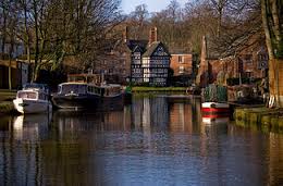
St Paul's Rambling Group
Heaton Moor
The Church Rambling Group meets on the second Saturday of each month (except Jan) at 9.30am on St. Paul's Rd outside the church. You do not have to be a church member to join our group and everyone will be very welcome to come along on the walk.
A lift to the starting point will be available for those without a car.
We have an interesting programme of rambles - I would describe as easy to moderate - which vary in length between 4 and 8 miles and usually finish up with a pub lunch.
Reports of walks in previous years can be found in archive
For more information contact Geoff Kay (geofftomkay@btinternet.com)
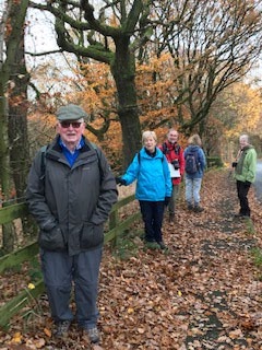
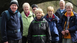
Our last walk
Adlington 9th October 2021
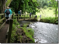
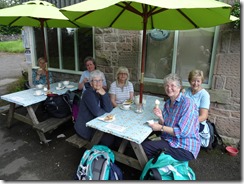
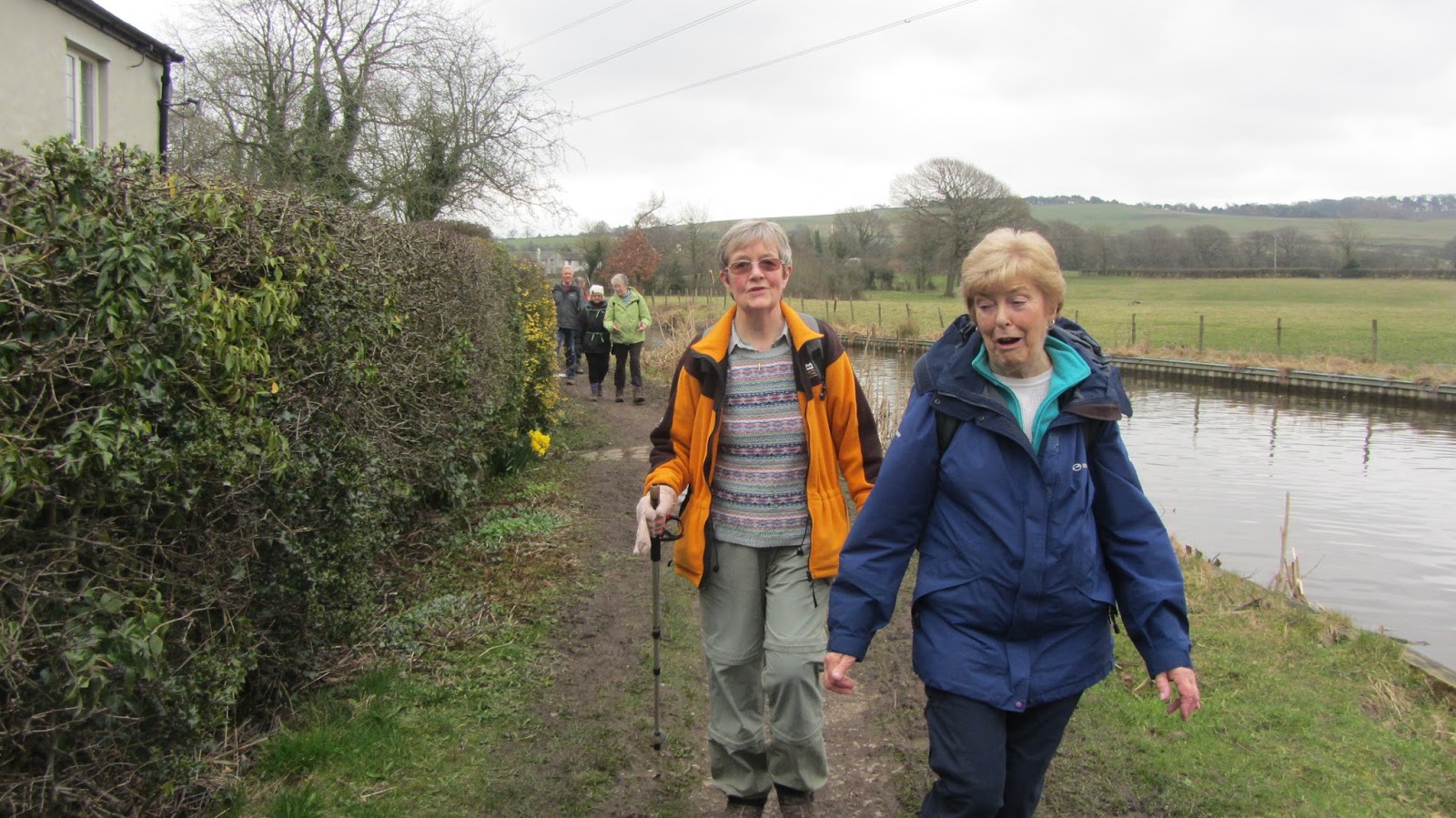
After a lay off of eighteen months we finally decided to try and resurrect our Walking Group and get out into the countryside to enjoy a ramble and pub lunch. We decided to organise a short walk and lunch and then try to get together a programme for the future hoping we would have sufficient interest to continue our activities.
I am pleased to report that we all enjoyed a short walk from the Windmill Inn at Adlington stopping off at St John's Church in Adlington village where a plentiful supply of cakes and coffee were available. After refuelling we continued our walk through Adlington and returned to the Windmill via the Macclesfield Canal.
We enjoyed an excellent lunch then had a short discussion about the future and we were able to find leaders until next March omitting January to avoid any harsh winter weather.
The next walk will be a four mile circular in the Mobberley area and details will be advised shortly once everything has been finalised. In December we decided that we would go ahead with the traditional Christmas Lunch and ramble. The Boathouse Restaurant, Sale Water Park has been booked provisionally for the 11th December and we shall be sending you full details shortly, so please put this date in your diary.
As we do have a programme to move forward we are looking for new members to join our group so that we can continue our walks throughout the year and get things back to normal after this awful pandemic we have just experienced.
 |
| Preparing to set off. |
 |
| Socially distancing crossing the field |
 |
| Where next! |
 |
| Jack Russel decides to tag along. |
 |
| Cows checking our progress |
 |
| Tight squeeze |
 |
| Coffee and cake at Adlington |
 |
| Spoilt for choice |
 |
| Ready to set off again |
 |
| Who said this was flat! |
 |
| Along the Macclesfield Canal |
 |
| Narrow boat passing under bridge |
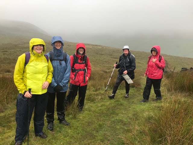
Eccles Pike via the Roosdyche - Saturday 14th March 2020
Eccles Pike via the Roosdyche
A group of seven, plus a lively Jack Russell, set off from Bugsworth Basin. We headed uphill from Buxworth across fields with very muddy patches, which nearly swallowed one of the party. Then we walked along the outer bank of the mysterious Roosdyche (Roman chariot track, Iron Age fortification, or glacial meltwater channel?). This gave us wide views over Whaley Bridge and the empty Toddbrook Reservoir.
From there we headed up the road past Ollerenshaw Hall to Eccles Pike. Some of the party made the final ascent to the top of the Pike which offers a panoramic view of Chinley Churn, Whaley Moor and Combs Edge. Getting down from it involved a “black run” of tussock grass. The rest of the group took the gentler route round the shoulder of the Pike. We regrouped and followed the long traverse back down to Buxworth, over several styles which the dog found very exciting. Finally we crossed back over the A6 to the Navigation Inn and a traditional pie lunch.
Walks from Navigation Inn Buxworth
 |
| Chinley |
 |
| Uphill |
 |
| At the Navigation Inn |
 |
| Roosdyche |
 |
| Toddbrook |
Marple Circular - Saturday 8th February 2020
Marple Circular
 |
| Lime Kilns Marple visited on this walk |
 |
| All set to go |
Our group of walkers set out on the 4.5 mile walk around the Marple area on the day before storm Ciara hit.
The walk started and ended at the Crown inn at Hawk Green, SK6 7HU. We walked up to The Ridge Methodist Church, in use for over 170 years, which afforded an excellent view of the countryside towards Stockport. We dropped down to the Peak Forest Canal which runs from Whaley Bridge. The Canal was under construction from 1794 to 1805. This canal is joined by the Macclesfield Canal at Marple. The Canal was primarily built to transport bulk manufactured goods and raw materials. Of particular note was the limestone brought from the quarries in Dove Holes in the Peak District.
Our walk along the canal past some of the 16 locks which form the Marple Flight of Locks. The locks have one of the steepest rises in Britain, 209 feet over a distance of 1 mile. The route took us to the nearby remains of the Marple Lime Kilns which are now protected as a Scheduled Ancient Monument.
The kilns were built between 1797 and 1802 by a cotton manufacturer, Samuel Oldknow. Oldknow had links to our church’s area as he had a bleaching plant in Heaton Mersey and lived in Upper Hillgate in Stockport. The limestone kiln workers lived in cottages built into the bank above the kiln tunnels. 1000’s of tonnes of limestone and coal were loaded into pots at the top of the kilns from barges moored in a spur of the Canal. You can view some remains of the kilns in a small park which conveniently provided benches were we could have our refreshment break.
From there, our route took us through the Memorial Park, part of the Middlewood Way and skirted the golf course back to the Crown Inn where we had a nice lunch.
Crown at Hawk Green - http://www.crownhawkgreen.pub/?LMCL=twOWAY
 |
| The Canal at Marple |
 |
| Crossing the bridge |
 |
| Taking a break |
 |
| Along canal towpath |
Goyt Valley - Saturday 9th November 2019
Our group set off for the walk near the Errwood Reservoir on a morning that had threatened rain which, fortunately, didn’t arrive. The starting point was at the Errwood Hall car park, adjacent to the reservoir. We made our way, with a slight detour to the remains of Errwood Hall (built in 1840 and demolished in 1934) for some of the party, following a path towards the “Riverside Path” which descends towards the River Goyt. The term “river” does not really describe what is in effect a stream at this point.
We continued until we reached a series of steps which led up to a road. A word of caution concerning the steps; the rise is steep and some of them are difficult to climb because of the height of individual steps.
The road we reached runs from the Errwood Reservoir towards Derbyshire Bridge. Following the road we passed by the disused loading bays for stone from the Goytsclough Quarry reaching the rise above the Packhorse Bridge. The bridge got its name from the packhorses used to transport the stone. The are indications that the removals firm of Pickfords started business here in 1670.
We returned to the Car Park by following the road and had a very pleasant lunch at the White Horse pub at nearby Disley.
 |
| Errwood Hall Car Park |
 |
| Errwood Reservoir |
 |
| Waterfall |
 |
| River Goyt |
 |
| Ruins of Errwood Hall |
 |
| Lego |
 |
| Errwood Reservoir from road |
Hawk Green, Marple - Saturday 14th September 2019
Not so much 'Three Men in a Boat' as 'Three Women and a Dog' who strode out from the Crown at Hawk Green up to the Ridge where we took in the view from the quaint little Methodist Chapel, which has been modernised and is still in use.From here a steep walk down to the canal meets one of the most picturesque parts of our walk,
Our first stop was Samuel Oldknow's Lime Kilns just away from the canal past some lovely gardens, where we learned quite a bit about the living conditions and the pros and cons of industrialisation.
Minutes later and we were strolling around Marple Park where the skate park was being well used as we enjoyed surrounding glorious views in the sunshine. Back along the canal we were just in time to see the last leg of the British Cycle Tour as they flew down Brabyn's Bow.
Past some allotments and Marple Cricket Club, where we witnessed a match in full whites, and we were on the Middlewood Way before turning onto the Cown Edge Way and we completed the final stretch across Marple Golf Course
A few road junctions later we were back at The Crown where we met up with other members of our group who had put in an appearance in good time for excellent food and drink, which we were able to enjoy in the garden. Because the regular St. Paul's group were unable to come, either because of illness, holidays or football matches, we shall probably repeat the walk next year.
http://www.crownhawkgreen.pub/
 |
| Down to the canal |
 |
| Picturesque cottage on our route |
 |
| Marina at Marple |
 |
| The Lime Kilns |
 |
| Tribute to the industrial past |
 |
| Along the canal |
 |
| Canal basin |
 |
| Path under road |
 |
| Locks at Marple |
 |
| Tour of Britain |
 |
| Support vehicle |
 |
| Crossing the Golf Course. |
Quarry Bank Mill and Styal Country Park - Saturday 10th August 2019
This walk came about during a discussion over coffee after Church probably two Sundays ago and was a bit of a corporate effort. Nothing was planned until some one mentioned Styal Mill and possibilities of lunch at the Ship Inn. One person had a much walked route embedded in her boots! This route also allowed the opportunity to cut back through the beautiful gardens if the prospect of the few short but sharp inclines was too much.
Firstly we had coffee in the Mill restaurant before ten of us set off from the old Mill Yard (featured in ‘The Mill’ TV series). We went up the hill from the Mill towards the Apprentice House but turned left along the track that skirts the outer edges of land round the original home of the Gregg family. This used to be a muddy path but in the last few years the National Trust has upgraded many of the paths on the estate, making them accessible to more visitors, including wheelchair users and children’s buggies.
We dropped down to the River Bollin which was swollen after the recent heavy rains. It was here that some of the group headed back through the gardens. The rest of us walked along the river leaving the Oxbow Bridge to our left and then up to the outer edges of the estate before going down into a gully and up the other side in very short order!
Passing the Northcliffe Chapel we turned back towards the Mill but at a higher level. We carried on at this height through the car park and over the fields towards the Wilmslow entrance to the estate. We walked back to the Mill Yard, through the beautiful woods, taking in the remains of the 18th Century quarry and going over Heron’s Pool Bridge before meeting up with the others.
e weather was muggy and wet interspersed with brilliant sunshine. We were joined for an excellent lunch by five non walkers. This was not a conventional walk by the St. Paul’s group but it was an altogether pleasant and convivial occasion.
HGL August 2019
 |
| Assembly point - Quarry Bank Mill |
 |
| Styal Estate |
 |
| Woodland Path - Styal Country Park |
 |
| Heading toward the garden |
 |
| Giant redwood tress |
 |
| Above the River Bollin |
 |
| Styal Cross |
 |
| Lunch at the Ship Inn Styal |
Vernon Park - Saturday 13th July 2019
 |
| Vernon Park - The Lily Pond |
Our original intention to do a round trip along the River Goyt from Vernon Park in Stockport was thwarted by a land slip that closed part of our path. Luckily we had reconnoitred the walk during the week and decided on a different route.
Our small group set out from the Vernon Park car park and aimed to reach the Goyt beyond the land slip by heading through Vernon to the adjacent Woodbank Memorial Park. The River Goyt joins the River Tame at Stockport to form the River Mersey.
Vernon Park was known as Pinch Belly Park in the 1860’s because of the hungry, unemployed mill workers who were employed to work in the park. Although previously neglected, a grant of £1.6m was awarded by the Heritage Lottery Fund in 2000 which has supported the wonderful restoration work. Look out especially for the drinking fountain, the lily pond and the bandstand.
We found a downhill path just beyond the museum and café in the park. It is worth noting that the 100 plus steps that go down from near the museum should not currently be used as there is a fallen tree blocking the way close to the top.
We continued our walk alongside the Goyt heading for, but not reaching, the bridge that is a couple of miles further on. Instead we headed uphill from the weir to reach the far end of Woodbank and returned to Vernon Park, using part of the Fred Perry Way, named after the 1930’s tennis champion. Fred was born in May 1909 in Portwood, Stockport which is near to Vernon Park.
The very pleasant walk ended with lunch at the Midway Pub a short drive from the park.
https://www.themidway.co.uk/
 |
| Ramblers - Selfie! |
 |
| Admiring the gardens |
 |
| Drinking Fountain Vernon Park |
 |
| Weir on River Goyt |
 |
| Carved memorial |
 |
| Blocked path |
 |
| Cannon Vernon Park |
 |
| Ornamental Urn Vernon Park |
 |
| Ornamental Bridge Vernon Park |
 |
| Wood Carving |
 |
| The Midway for lunch |
Eyam, Peak District - Saturday 8th June 2019
A lovely walk, but the blustery wind and the rain ever present in the air did its best to put us off. However the intrepid walkers from St Paul’s donned boots, rain jackets scarves and hats and set off from the car park near the museum. In the event, the solid downpours on the Manchester side of the Pennines left us alone
Eyam is often referred to as the Plague Village. During the 17th century the villagers isolated themselves from the outside world as they were decimated by the dreadful disease that killed off whole families in quick succession.We saw the evidence of this as soon as we began to walk through the village as too many of the 17th century cottages have plaques listing the names of those who had died.
The walk took us out to the east of the village up a steep quiet road until we reached more open country. We were rewarded with wonderful views but also with the bleakness and isolation of the Riley Graves. As we began our descent to the River Derwent we could see Curbar Edge and Froggatt Edge in the distance. We then walked south along the river, having first looked at Froggatt bridge which has arches of unequal sizes.
We turned west away from the river and climbing upwards on footpaths we reached Stoney Middleton. This village is on a route to Sheffield and Chesterfield and many people think it looks gloomy from the road as they whizz through it. Approaching as we did, it emerges as a beautiful ancient village. We passed the ‘alleged’ Roman Baths before visiting the unusual Church of St Martin which is octagonal and one of only two such churches in the country. From the village it was a bit of a pull upwards to the Boundary Stone. During the Plague food was left here for the Eyam villagers to collect without contacting the ‘outside world’.
We were soon back in Eyam and the welcoming warmth (and Cakes!) of the Eyam tea rooms.
Eyam is well worth a visit as is Stoney Middleton.
 |
| Riley Graves |
 |
| Froggat Bridge |
 |
| Ramblers - quick break |
 |
| Church of St Martin |
 |
| View over Peak District |
Diggle - 11th May 2019
The first question about our May walk was “what is a Diggle?”. The name comes from the Saxon word “degle” meaning valley. The original hamlets housed farm workers and loom operatives. We passed many of gritstone buildings with their distinctive mullioned windows. These were designed to support bigger windows to admit more light for the workers inside.
The walk covered 4.5 miles in mainly dry and fair weather. Our group of eight set out from the public car park in Uppermill and climbed up towards the Pennine Bridleway National Trail, flanking the Saddleworth moors. We headed towards the Diggle Hotel pub which was unfortunately closed. This did not stop us from having a short refreshment break there on the outward journey and from using the garden benches for our lunch break on the return leg!
We dropped back to join the Huddersfield Narrow Canal where horses were routinely used to pull pull the barges. However, a canal tunnel was necessary to pass beneath the hills. Here the boats were moved by professional “loggers” who lay on their backs on the boat’s cabin top and “walked” along the roof of the tunnel to propel the boat.
This tunnel, the Standedge Tunnel, was the longest (over 3 miles), the highest above sea level (645ft) and deepest underground (636ft) in Britain. It is so narrow that only one boat at a time could use it, taking around 2 hours. The canal was completed in 1811, used until the 1920’s, and reclaimed in the 1990’s.
Our final point of call was for a well deserved ice cream at Grandpa Greens located on the canal before returning to the starting point.
 |
| Our group setting out from Uppermill |
 |
| The railway cutting through Uppermill |
 |
| Looking back on Uppermill |
 |
| W H Shaw's grade 2 listed Pallet Mill |
 |
| A friendly local |
 |
| A view of the moors near Saddleworth |
 |
| Standege Tunnel Map |
 |
| Entrance to tunnel. |
 |
| Blue plaque to Thomas Telford |
 |
| Grandpa Green's Cafe |
 |
| Huddersfield Narrow Canal |
 |
| First of the ducklings |
The Tolkien Trail, Hurst Green - Saturday 13th April 2019
A party of eleven of us set off from the Shireburn Arms, Hurst Green to explore the Tolkien Trail in the Ribble Valley. The first leg of the walk takes you across fields from which you have fine views of Pendle Hill and the surrounding countryside. Eventually we reached Stonyhurst College the Jesuit School with it's fine Grade 1 listed buildings.
From here we made the descent into the Ribble Valley passing Cromwell's Bridge over the River Hodder and named after him when he marched his army across on the way to Walton-le-Dale to fight the Battle of Preston in 1648. The route then leaves the river and follows farm tracks to reach the River Ribble at the junction of the two rivers.
The path continues along the banks of the Ribble undulating through the beautiful Lancashire countryside. On the way you pass the Jumbles where the river tumbles across the limestone ridge and the mysterious stone cross on the adjacent hillside, Finally you reach the graceful aqueduct which arches across the river.
From here you make the climb from the river back to the pub where you can enjoy an excellent lunch in the old manor house and now the Shireburn Arms Hotel. The distance was about six miles.
 |
| Ramblers at the start |
 |
| Pendle Hill |
 |
| The Observatory Stonyhurst School |
 |
| Stonyhurst |
 |
| Cromwell's Bridge. New road bridge in background |
 |
| Ready for a coffee break |
 |
| Junction Rivers Hodder and Ribble |
 |
| Along the Ribble river bank |
 |
| The Junbles |
 |
| Steep climb back to the pub! |
 |
| Waiting for lunch
|
Plumley Circular - Saturday 9th March 2019
 |
| Golden Pheasant Plumley |
We started this ramble at the Golden Pheasant in Plumley and after a short walk through the village we were soon crossing open fields on our way to the ancient woodland known as Holford Moss. At this time of year last summer's bracken was still in evidence and the spring flowers had yet to come into bloom but there is always something of interest and after the wet weather there was plenty of fungii around to make the visit worthwhile.
The next part of the walk takes you across the old salt workings and eventually on to Holford Hall the home of the Cholmondeley family. From here we crossed more open farmland and back to Plumley for an excellent lunch at the Golden Pheasant. Distance about 4 miles
Golden Pheasant Plumley
 |
| Ramblers at the start |
 |
| Over the stile |
 |
| Woodland - Holford Moss |
 |
| Hoof Fungus (Fomes fomentarius) |
 |
| Birch Tree - Holford Moss |
 |
| Valves from old salt workings |
 |
| Coffee Time |
 |
| Holford Hall |
 |
| Serious discussion |
 |
| The lone rambler |
 |
| Storm clouds gathering |
Our last walk - Saturday 9th February 2019
Bamford & Crimble - Rochdale, Lancashire
|
|
|
Carr Wood |

The walk started at the Grapes Inn, Bamford and the first leg took us across open fields at the rear of the pub and down to School Lane. From here we entered Carr Wood at the old tea rooms. Plenty of interest to see with the weir and abandoned mill by Naden Brook. The path continues through this river valley which even in winter has a unique beauty. We continued downstream crossing the waterfall and the landslide, now made easy by the metal walkway, and eventually arrived at Simpson Clough.
From here we followed Ashworth Road and then across Bury Road to join the foot path along the river Roch, After crossing Bamford Rd by the old Hooley Bridge Spinning Mill we again joined the path along the Roch until we reached the footbridge to take us into Queens Park in Heywood.
At this time of year the herons take up residence in their nesting site on the island in the centre of the boating lake and we stopped for a coffee break with the expectation of seeing the birds in flight. Unfortunately it was a very windy day and only three birds took to their wings. The remainder stayed in their nests and we could only observe them resting with the help of binoculars.
Refreshed by the break we continued past the cricket ground before crossing Millers Brook to again join the path along the Roch to Crimble Mill. Originally a woollen mill this now grade 2 listed building is sadly in dire need of repair. It was from here we began the climb out of the valley along Crimble Lane and then back to the pub along War Office Rd.
As usual we had lunch organised and hungry after our exertions we all tucked into an excellent meal which everyone enjoyed. Walking distance 5 miles. Time 3 hours.
 |
| Ramblers at the start |
 |
| A wet path after heavy rain |
 |
| The weir at Carr Wood |
 |
| Abandoned weaving mill from 19th century |
 |
| The path through Carr Wood |
 |
| Iron ore |
 |
| Care crossing waterfall |
 |
| The waterfall |
 |
| Plenty of water rushing by. |
 |
| Walking along the River Roch |
 |
| From footbridge into Queens Park. 1930 road bridge in background |
 |
| Anybody seen any herons? |
 |
| Back along River Roch |
 |
| Crimble Mill |
 |
| Climbing up Crimble Lane |
 |
| First sign of spring |
 |
| Lunch at the Grapes in Bamford |
Dunham Massey - 12th January 2019
In January we do not have an organised walk because of the unpredictable weather and the absence of members on holiday. However, this year we decided to meet for a pub lunch which was extended to coffee at the National Trust Visitor Centre, a walk in the park and a long lunch at the Axe & Cleaver in Dunham Massey.
Eleven members turned up in the coffee shop and after a refreshing cup of coffee we sorted ourselves out into two groups. Those who felt like a longer trek around the grounds set off on a brisk 5km walk. The remainder opted for a leisurely stroll around the gardens which even in winter time are full of interest. Photographs showing the garden can be found below.
Everyone enjoyed their selected walk and we all met up again at the pub for an excellent lunch. It was agreed that we should repeat this type of event next year.
National Trust Dunham Massey
Axe & Cleaver Dunham Massey
 |
| The 'Garden' group. |
 |
| Hellebores and Snowdrops |
 |
| More Hellebores and Snowdrops |
 |
| Witch Hazel |
 |
| Winter colour |
 |
| Crossing the stream |
 |
| Aconites |
 |
| Silver Birch and Snowdrops |
 |
| Early flowering Narcissus |
 |
| Witch Hazel |
 |
| Highly scented winter flowering Honeysuckle |
 |
| Daphne again highly scented |
 |
| Oldest Oak in Dunham Massey |
 |
| Here is proof that some of us did walk! Canal towpath adjacent to park |
Ramble and Christmas Lunch - 8th December 2018
Torrs River Park & Goyt Valley
Traditionally this usually a short walk followed by a long Christmas lunch. We started from the Torrs River car park in Hague Bar, New Mills and made the short decent to the river valley below. From here we continued along the path by the Goyt looking forward to making the crossing by the Millenium Bridge.Unfortunately on arrival we found the bridge closed and had to make a detour up the hill and into New Mills so we could only view the spectacular bridge from the road above. Eventually we found our way back down to the river where we stopped in the gorge for coffee.
The ramble then continued along the river until we met the bridge across and the pathway to the Peak Forest Canal. We then walked along the canal to Hague Bar and returned to the car park. A distance of 4.5 miles.
The important part of the day followed when we retired to the Pack Horse Inn, New Mills to enjoy an excellent three course Christmas lunch complete with Christmas Pudding and crackers.
http://www.packhorseinn.co.uk/
 |
| Ramblers at the start |
 |
| Millenium Bridge Torrs River Canyon |
 |
| Time for coffee |
 |
| Railway viaduct New Mills |
 |
| Along the river bank |
 |
| Friendly LLama |
 |
| Marina Peak Forest Canal |
 |
| Pack Horse for Christmas Lunch |
Our last walk- Saturday 10th November 2018
Ashworth and Norden, Rochdale.
 |
| St Jame's Church, Ashworth |
A party of six set out from Norden, Rochdale for this 5 mile ramble through the local countryside.From the car park we turned into Black Pits Lane and very soon arrived at the footpath alongside Naden Brook. At the bridge next to remains of the old mill, we crossed the river, and then began the climb out of the valley to a farm track which leads up to the ancient church of St James Bamford and the former pub known as the Chapel House, which is now a private residence.
Here we stopped to admire the old church with its interesting grave stones and the views across Lancashire to Manchester and Derbyshire. We then crossed the fields to the old schoolhouse before joining Ashworth Rd to take us down to Simpson and Gelder Cloughs. Unfortunately we found the road closed because of a landslide and we had to retrace our steps and take an alternative path down to the valley. Not wishing to miss out the scenery at Simpson Clough we took a detour through the valley knowing that we would have to retrace our steps, but it was worth the effort and we found a grassy bank for a coffee break.
Returning the way we had come we then passed through Carr Wood and walked along the Naden Valley to Black Pits where we extended the walk by following the Millcroft Brook up to the tearooms (now closed) and then back to our start point.
Lunch followed at the Bridge Chippy where we enjoyed traditional Lancashire fish and chips!
Bridge Chippy Norden
|


Our last walk - Saturday 20th October
Lymm - Byeways and canals

On a sunny Saturday morning eight of us set off from the Henry St car park in the centre of Lymm for a walk around the surrounding countryside. For the first leg of the route we followed the tow path of the Bridgewater Canal heading towards Manchester. After about 1.5 miles we left the path to join the B5159 which took us under the canal. After continuing along the road for about half a mile we reached a stile on the left which took us into a field of sugar beet where we made a stop for a coffee break.
The path then continued along the sides of the field and eventually we entered Spud Wood. After a short walk through the trees the route followed along the byeways of Lymm until we finally arrived at St Mary's church.
From here we joined the pathway to walk around Lymm Dam and finally back to our start in Lymm.The walk was about 5 miles and there is plenty of interesting scenery and wildlife along the track.
Lunch was at the Spread Eagle in Lymm.
How sugar is made from Beet. http://www.sucrose.com/lbeet.html
 |
| Granthams Bridge |
 |
| On the towpath |
 |
| Field of Sugar Beet |
 |
| Coffee Break |
 |
| Oughtrington |
 |
| St Mary's Church Lymm |
 |
| Lymm Dam |
 |
| Cormorants drying out. Lymm Dam |
Barley Circular - Saturday 8th September 2018
Barley Circular
 |
Village Hall Barley |
We left St. Paul’s Church under a threatening sky towards the beautiful village of Barley in Lancashire only to find the rain had set in on our arrival about an hour later.
Six of us left the car park for the old water works building which now boasts a glorious conversion to apartments.Next over the footbridge to our first climb of the day over a rather boggy, clumpy set of fields. As expected, the path proved a little difficult to follow here but after a bit of team work, we were back on track passing a farmhouse and over the hill towards Newchurch, The village is famous for its ‘Witches Galore Shop’ and usually has three old stuffed crones sitting outside but their absence probably reflected the extreme weather conditions that proved too much, even for them! Originally the village was called Goldshaw Booth but the Newchurch name came into use in October 1544 when John Bird, Bishop of Chester, consecrated the new church of St. Mary. Prior to that, there had been a chapel recorded on the site of the current church since 1250.There is an oval set in the west face of the tower known as the ‘all seeing eye of God’, reputed to protect the villagers from evil.
This and other surrounding villages are, of course, famous for their ‘witches’ who suffered the trials in Lancaster Castle following various reported activities which were put down to their craft.
We escaped the rain by sheltering inside the church where we were greeted by a couple of ladies who had, following the cancellation of their village flower festival, decided to provide coffee and homemade cake for anybody crazy enough to venture out in such dire conditions.As we dried our gear and settled down to coffee and cake, they explained how the church had become part of the Blackburn Diocese only in 1926, so we said we would think of them in 2026 when they would be celebrating their centenary within the diocese.
Much as it would have been lovely to spend all day in the church, we set off in intrepid fashion along the road towards Sabden Fold, past the Shekinah Christian Centre.Then came our second climb over Driver Height which is not only terribly steep, but tantalised us with many false summits before reaching the top, made all the more ‘fun’ by the driving rain.Despite all these forces working against it being a nice walk, everybody came together in camaraderie fashion and decided this was a good place to take numerous photos of the group, while we tried to stumble our way down the steep drop toward the reservoir. Then along the easiest part of the walk back to Barley following the reservoir.
We passed Pendle Hill which is, of course, famous for George Fox who experienced his vision there which led to his forming The Quaker Movement.
Back at the car park, we dried off and headed for ‘The Barley Mow’ who welcomed us with some very good food.
A great day and turnout considering the weather, though maybe the next one should be planned for a nice hot summer’s day.

 |
| Preparing to set off |
 |
| At the summit Driver Heights |
 |
| Path down to Ogden Reservoir |
 |
| Nearly back at the start |

![]()
The Barley Mow https://barleymowpendle.co.uk/
Marple Bridge - Saturday 18th August 2018
MARPLE BRIDGE

A slightly larger than normal group of 11 walkers started the 3.5 mile circular route from Brabyns Brow Park in Marple Bridge. The walk took us past the site of the demolished Brabyns Hall which had been used as a military hospital in the First World War. We followed the course of the River Goyt, taking time to look at a discarded foundation stone from Monsal, to stop and admire the listed Iron Bridge. This was built in 1813 by the Salford Iron Works. A team of Friends of The Park were hard at work on keeping it free from weeds.
We took a short diversion to look at the point of confluence of the rivers Goyt and the Etherow before crossing the river at Compstall and continuing into Redbrow Wood. After heading across farmland we reached the steps leading up to the Marple Aquaduct which is 100ft above ground level.
Following the Canal, we passed the start of of Marple’s 16 locks and descended a path back to Brabyns Park. After the interesting walk the group adjourned to The Railway pub in Marple for lunch.
The Railway , Marple - https://www.robinsonsbrewery.com/railwayrosehill
 |
| Setting off - Brabyns Park |
 |
| Iron Bridge |
 |
| Manufacturer |
 |
| Break for a chat! |
 |
| View Point |
 |
| River crossing |
 |
| Quick break down by the river |
 |
| Plenty of places to rest on this route |
 |
| Aqueduct build details |
 |
| Crossing the aqueduct |
 |
| Lunch at 'The Railway' |
Elmerhurst Woods and Lyme Park
The group started the walk from the Nelson Pit Visitor centre car park. The miners here used to work 400 feet underground for the princely sum of £1.95 for a 5 1/2 day week! We walked a short distance along the Macclesfield Canal which had been used to ferry the coal by barges pulled by 14 horses.
We followed a circular route utilising part of the Middlewood Way which was originally the Macclesfield to Marple railway which was open from 1869 to 1970. We walked through two woods (Elmerhurst and Crow) leading to the National Trust owned Lyme Park. A short refreshment break was taken in the grounds before completing the circuit to have lunch at the Boars Head pub where the pies are to be recommended.
 |
| Nelson Pit Start Point |
 |
| Along Macclesfield Canal |
 |
| Crossing canal to enter Lyme Park |
 |
| No muddy paths here |
 |
| Elmerhurst Woods |
 |
| Lyme Park |
 |
| We begin our way home |
 |
| Boars Head - waiting for the pies to come! |
The Ingleton Waterfalls Trail - Saturday 9th June 2018
On a warm sunny Saturday a party of 8 of us set out for Ingleton to explore this very scenic area of the Yorkshire Dales. The journey to the start of the walk took us about an hour and an half from Stockport and entrance to the Trail is £6 per head but includes the car park.
The footpaths are all well maintained and there are ample directions and points of interest along the route. Although the walk is listed as moderate there are steps to be climbed at each fall to the next level and plenty of time is required to view the magnificent waterfalls, local scenery and occasionally rest the weary legs.
Half way round we stopped to enjoy a picnic lunch in the sun before making our way back to the start point. Everyone enjoyed the walk immensely but we were all glad to reach the teashop at the end and appreciate a cup of tea and cake.
 |
| Setting off |
 |
| Swilla Glen |
 |
| Pecca Falls |
 |
| Plenty of signs along the route |
 |
| Tricky manoeuvre |
 |
| Into the woods. |
 |
| Waterfalls |
 |
| More water |
 |
| Stop to admire the view |
|
| Multiple waterfalls |
 |
| Ingleton Village |
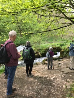
Lathkill Dale - Saturday 12th May 2018
Our route started at Over Haddon above Lathkill Dale near Bakewell and I remember thinking, as we descended the steep road to the bottom of the Dale, that at the end of the walk this hill would be the sting in the tale.
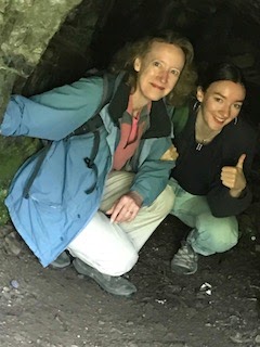
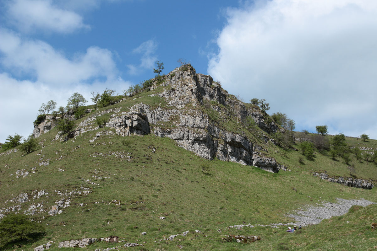
The walk along the dale was beautiful with the sparkling water to our left. The path starts as a very well constructed track but as we got deeper and deeper into the dale the track became more rugged and the feeling of walking in the bottom of a steep sided valley was more intense. There are caves on the way and one was explored by two of the younger group members!
To reach the head of the dale the route was really quite challenging for some of us and required care by all. Eventually we were at the top of the cliffs and began our walk back. The views were such a contrast to the earlier ones. These gave the wonderful feeling of expansiveness that is so precious to urban dwellers. It was a D of E weekend and it was great to see cheerful groups of young people out in the country side working together and enjoying themselves. Some of their map reading needed a bit more work though and one of our group gave a good piece of advice saying that if you thought you had to climb a wall with no stile you had gone wrong.
From here a well trodden path went through a farmyard where a Blue poster pointed the way to the various nearby places. The route then dropped back into the valley bottom and we walked somewhat slowly back to Over Haddon. Of course there was that slog up to the car park but there was the reward of the Garden tearooms with huge pieces of fantastic cake. A good walk with a few challenges and beautiful weather.
 |
| Setting off up the Dale |
 |
| The path follows the river for much of the walk |
 |
| Enjoying a break by the waterfall |
 |
| Caving in Derbyshire! |
 |
| The path to the head of the Dale |
 |
| All Routes thataway! |
 |
| First of the summer flowers |
 |
| Marsh Marigolds |
 |
| Cowslips, early purple orchids and meadow saxifrages . The limestone grassland was full of them. |
Dunham Massey - Saturday 14th April 2018
Our group repeated a short, 4 mile, circular walk from the Axe and Cleaver at Dunham Massey. The weather was a distinct improvement on last September although parts of the canal path were muddy. No heron was sighted this time unfortunately but a canoe was spotted on the canal. The walk took us through the village and the National Trust site where some retail therapy was undertaken in the NT shop! Everyone enjoyed the meal at the Axe and Cleaver at the end of the walk.
Dunham Massey House and Grounds
Axe & Cleaver Dunham Massey
 |
| Towpath on BridgewaterCanal |
 |
| Lone canoeist on canal |
 |
| Coffee time. |
 |
| Don't fancy that muddy field |
 |
| We'll use this muddy path instead |
 |
| Ancient oak tree entrance to Park |
 |
| Axe & Cleaver for a good lunch. |
Alderley Edge - Saturday 14th March 2018
We had a pleasant walk at Alderley, mostly on the south side of the Macclesfield Road, through the old mine workings and Windmill Wood, ending up on the Edge at Stormy Point, with a view across to Lyme Park and the Peak District. We had to negotiate a couple of quagmires and one tunnel under a fallen tree. Fortunately the walk just fitted into the gap between two bands of heavy rain. Lunch at the Wizard was good, if very slow.
 |
| National Trust Car Park |
 |
| Alderley Edge |
 |
| View across Cheshire |
 |
| Woodland sculpture |
 |
| Don't think he will be winning the 'National' |
 |
| Lake on route |
 |
| Heading back across the fields |
 |
| Tree hazard |
Greenbooth and Naden Reservoirs - Saturday 10th February 2018
Due to extremely wet and cold weather conditions we had to cancel this walk. We shall probably tackle it later in the year when the weather will have improved.
Christmas Ramble & Lunch - 9th December 2017
 |
| At the start on a cold and frosty morning |
This year our Christmas ramble started from the Greyhound Inn at Ashley in Cheshire and a party of twelve set off to explore the paths and bye ways of this pretty Cheshire village. As always, this walk is more about lunch than ramble and the short four mile walk meant we were back at the Greyhound in plenty of time to enjoy an excellent Christmas Dinner in warm, comfortable surroundings.
Details of the walk can be found at http://www.cheshireeast.gov.uk/leisure,_culture_and_tourism/ranger_service/free-walk-leaflets.aspx under Rail Walks.
Greyhound Inn http://www.thegreyhoundashley.co.uk/
 |
| Off into the snow |
 |
| Coffee break in the cold |
 |
| Muddy path by M56 Motorway |
 |
| Tripping through the mud. |
 |
| Back onto the fields |
 |
| Making our way to the pub! |
 |
| Christmas dinner at the Greyhound |
The Saltscape Trail - Saturday 11th November 2017

A party of ten left the Lion Salt Works, Northwich on a fine November Saturday to explore the Saltscape Trail. The first part of the walk took us along the Trent & Mersey Canal for about a mile and at this point we crossed over the bridge and into Maybury Country Park. From here we followed the path along Budworth Mere to the Coffee Shop where we stopped and enjoyed a break in the warm sunshine.
At this junction the route crossed fields but with all the recent rain, which had made the paths extremely muddy, we elected to follow the road to the Anderton Lift. Only a short walk but there is a narrow bridge without footpath and caution should be exercised if following this route. However, we were able to join the canal again very quickly which took us directly to the Lift.
Unfortunately the lift is not working at week-ends in winter and we were disappointed not to see the boats going up and down. The Visitor Centre is open but time did not permit a visit on this occasion.
It was here we joined the Saltscape Trail which followed the River Weaver before joining the paths to take us around Neumanns Flash and back to the Salt Works. Estimated distance about 5 miles.
At the end of the walk we enjoyed an excellent lunch at the newly refurbished 'Cock at Budworth'.
Links
Lion Salt Works Cock at Budworth
 |
| All ready to go - Salt Works Northwich |
 |
| Trent Mersey Canal |
 |
| Reflections |
 |
| Autumn colours - Beech Trees |
 |
| 11/11 at 11 a.m. Two minutes reflection. |
 |
| Bird watching at Budworth Mere |
 |
| Path through Maybury Country Park |
 |
| Entrance to Anderton Lift from Trent & Mersey Canal |
 |
| Marshalls Wood |
 |
| Mmmm,,,Cheese cake scone at the Cock at Budworth |
Dunham Massey - Saturday 9th September 2017
Our small group started our four mile walk from the National Trust car park at Dunham Massey. The first part of the walk through the village was through heavy rain but spirits were raised when we came upon the local craft brewery! Unfortunately we were unable to sample any of the prize winning beers at the time as the brewer was busy. However, more on this later.
We then walked along the canal towpath alongside the River Bollin and over an aqueduct. The weather improved significantly and we were able to have a coffee break in full sun. We were lucky enough to get very close to a heron on the path who showed us great disdain as he assumed he owned that stretch of the canal.
Coming down from the raised canal, we walked over a cobbled path into Little Bollington, over a footbridge onto a grassy path and into Dunham Park. We saw a deer and various waterfowl on our way back to the car park.
We had a very pleasant lunch at the Axe and Cleaver pub where we were able to sample the beer of the Dunham Massey Brewing Company!
 |
| Our group taking shelter from the rain |
 |
| The heron guarding his patch |
 |
| The coffee break in the sunshine on the tow path |
 |
| St Marks |
|
|
| The school house built in 1759 |

 |
| Obviously he can’t read! |
Hartington - Saturday 12 th July 2017
Again a walk where the weather did not look at all promising but was actually sunny and pleasant. We started in the small but 'beautifully formed' village of Hartington which is tucked away about 8 miles SE of Buxton. The walk was a mainly 'easy' ramble along the river Dove and took in two other lesser known Dales namely Wolfescote Dale and Biggin Dale. The second moderate uphill stretch rewarded us with sparkling views of the Peak District. There was plenty of chatting along the way which added to the enjoyment-as did the teashop back in Hartington. Yes of course we indulged! Thanks to Janet who lead us so confidently.
 |
| Now where do we go from here? |
 |
| Short uphill stretch |
 |
| Across the Dove |
 |
| Should you be walking here! |
 |
| Tea and cake indulgence! |
Monsal Dale - Saturday 8th July 2017
A small group of four made the journey to Monsal Dale, close to Bakewell, in warm and sunny weather. The walk was based on the Monsal Dale and Brushfield circuit starting from the lovely vantage point of the Monsal Head Hotel. From there you could look down into the valley some 250 feet below. The view is spectacular over the River Wye.
Our walk took us over the Headstone Viaduct and along the Monsal Trail through both the Cressbrook and Litton Tunnels, doing our best to avoid the cyclists! John Ruskin, the writer was critical of the Viaduct when it was built in 1863 as it destroyed the beauty of the Dales. However, time moves on and a preservation order was placed on it in 1970. The curved tunnels were cut through limestone and have a combined length of nearly 1,000 yards (or 914 meters in new money).
We spotted an abundance of wild flowers along the Trail; including wild orchids, harebells and Scabious Devils Bit.
We then left the Trail and headed up a long, steep incline to the High Dale. Walking through some disused mine-workings led us to the village of Brushfield and dropping down to the High Dale dry valley. We came in sight of the Hotel and had to negotiate a steep, flinty path to bring us back to the Trail and the final ascent of the 250 feet of steps back to the Hotel.
We appreciated the later than anticipated lunch and a cool drink at the Hotel, followed by an ice cream sitting on a bench overlooking the valley in glorious sunshine.
 |
| Monsal dale from Monsal Head |
 |
| Ramblers |
 |
| Cressbrook from Monsal Trail |
 |
| Inside the Litton Tunnel |
 |
| Litton Mill |
 |
| Climbing High Dale |
 |
| Through the High Dale |
Parkgate - Saturday 10th June 2017
It was pouring with rain as just four of us left St Paul's Road for the drive to Parkgate.
Parkgate is on the Wirral Peninsular in Cheshire and is a curious and quirky place. It used to be an important sea port on the River Dee in the 18th Century. Well known people such as the composer Handel sailed from here to Dublin. However the Dee estuary silted up and the sea retreated a long way out from the 'sea front' but the sea wall remains.
We walked north with the silted up reed beds on our left and the Welsh Hills rising above the distant remaining Chanel of the river Dee. We turned East for a short stretch and then South-ish, along tracks, minor roads and bits of the Wirral Way. Part of the route took us over the Neston Golf course and then along it's edge where we enjoyed stunning views of the river channel, and the estuary mouth. We worked our way round to 'The Old Port'. This has sandstone blocks from the original port and provided a good lunch stop. The final part of the walk was right on the edge of the reed beds and was rather damp and muddy underfoot.
When back in Parkgate, it was time for tea and cake!
This was a very pleasant and peaceful walk of about six miles. There were wild flowers everywhere; including roses and orchids.The reed beds are home to many birds. Binoculars would have been useful! We saw the expected gulls but also spotted herons and oyster catchers.
So, did we get wet? No, it was totally dry-if you discount a few spits and spots at our lunch spot!
 |
| Moel Famau |
 |
| Parkgate |
 |
| Ramblers |
 |
| Saltmarshes |
Worsley - Saturday 13th May 2017
You would not normally associate Worsley, Greater Manchester with the country side and a place for a ramble but within this suburb of Manchester lies a walk which you would only expect to find much further afield.
Starting from the car park adjacent to the motorway the route takes you along the Bridgewater Canal towards Manchester, Then at Monton Green your turn right, at the 'lighthouse' on the left, onto the Roe Green Loop Line. This line originally linked Worsley with Bolton before closure in 1969 It was reopened in 2016 as a cycling and pedestrian route and is now an attractive woodland walk teeming with wildlife.
Leaving the Loop Line at Beeson Green a short walk along the road brings you to the entrance to Worsley Woods. Another attractive woodland full of wildlife and native plants. Wood carvings of plants are to be seen along the path and if you look carefully in the locations the wild plants can be found in the undergrowth
The path eventually opens out into the Old Warke Dam where the old estate lodge, known locally as the 'Gingerbread House' is sited. Further along is a platform extended into the dam and from here there are views of the woodlands across the water and the 'Aviary' an old hunting and fishing lodge which belonged to Lord Egerton. As expected there is plenty of water fowl to be seen in this area.
Following the route at the side of the water you come to a path on the right leading to Worsley Delph. Again this is another natural woodland area full of interest and access has been made easier by the addition of a boardwalk in the wet areas.Returning from the Delph a short walk brings you back into Worsley and on the last stretch you have the opportunity to see the part of the old industrial heritage before returning to the car park.
There are plenty of tearooms, restaurants and pubs for lunch or a snack at the end of the walk.
 |
| Coffee break Worsley Station |
 |
| What time is the next train! |
 |
| Roe Green Loop Line |
 |
| Through the tunnel |
 |
| Wood carving entrance to Worsley Woods |
 |
| Worsley Woods |
 |
| OLd Warke Dam |
 |
| Viewing platform. Aviary Lodge in background |
 |
| The Delph |
Disley Circular - Saturday 8th April 2017
On a warm sunny Saturday eight of our members set off to walk a 5 mile circular ramble around Disley. Leaving the White Horse Inn we took the path through the church yard to the first part of the walk which was to take to the top of the Bowstones. The path climbs steadily along the edge of the Peak District and although the track is difficult in sections the route is not too demanding. The final leg to the top is on tarmacked road and although the road rises steeply it is only for a short distance and once on the summit we were able to enjoy excellent views across Derbyshire, Greater Manchester and Cheshire. Of course we could not walk up to the Bowstones without stopping to look at these 10th Century Anglican crosses with their interlaced carvings and lettering.
After a coffee break we then made the descent down from the ridge and into Lyme Park. The route takes you through woodlands and parkland until eventually you reach the Hall in the centre of the park. From here we set course for the East Gate which takes you up the hill past the Cage and the Deer Sacntuary and onto the appropriately named Mudlane which returned us back onto the pathway to Disley. The walk took us around 4 hours complete but it was a warm sunny day and the excellent scenery and wildlife to see on the route made it all the more enjoyable.
An enjoyable lunch in the White Horse followed the end of the walk.
White Horse Disley
 |
| White Horse Disley |
 |
| On the road to the Bowstones |
 |
| Reservoir on edge of Lyme Park |
 |
| Drinks break |
 |
| The 'Bowstones' |
 |
| The Peak District from Bowstones Ridge |
 |
| 'TheAngel' of Lyme Park |
 |
| Woodland in Lyme Park |
 |
| Driveway to the Hall |
 |
| On the road past the Cage |
 |
| Red Deer in the sanctuary at Lyme Park |
Nelson Pit Canal Walk, Higher Poynton. Saturday 11th March 2017
After a week of extremely wet weather we decided to abandon open fields and instead elected for a canal walk and old railway tracks. Starting from Nelsons Pit at Higher Poynton we joined the Middlewood Way and headed out towards Marple. At Middlewood we then joined the path to the Macclesfield Canal and turned south to walk towards our start point at Higher Poynton. From here we continued along the canal to Wood Lanes Marina where we rejoined the Middlewood Way to return to the start point once again. The distance was about 5/6 miles and the walk took around three hours with a coffee break.
Lunch was taken at the Boars Head Pub in Higher Poynton where we enjoyed an excellent home made mince and onion pie.
 |
| Car Park at Nelson Pit, Higher Poynton |
 |
| Waterfall along the Middlewood Way |
 |
| Canal Towpath - Lyme Park in background |
Birtle - Saturday 11th February 2017
The first walk of the 2017 season started from the Pack Horse Inn, Birtle on the lower slopes of the Pennines above Heywood. On a cold wet windy Saturday we set off from the Inn to follow the road north on a long steady climb to the hamlet of Birtle where we then turned to follow the path along the edge of Ashworth Valley. Unfortunately from the top the views over Lancashire were obscured by cloud and mist but the views of the wooded valley with Cheesden Brook running through provided some compensation.
We made a detour from the route to visit Nabs Wife the site of the former Tea room and weaving mill known as Kershaws Bridge. The site is now occupied by a private dwelling although the old mill yard is still evident. From here we continued along the edge of the valley before turning to take the path across fields to return to the start point and a long leisurely lunch in the pub!
Further information:
http://www.packhorseinnbury.co.uk/about
http://heywoodmonkey.blogspot.co.uk/2013/07/the-lost-mills-of-cheesden-valley.html
 |
| Pack Horse Inn Birtle |
 |
| View of Ashworth Valley |
 |
| Entrance to Nabs Wife |
 |
| Nabs Wife 2017 |
 |
| Site of Mill and Tea Room |
 |
| Cheesden Brook, Ashworth Valley |
 |
| Waiting for our dinner! |
The Tea Room I remember. Situated at Nabs Farm
Christmas Ramble and Lunch - Mobberley
The Christmas Ramble was held last Saturday in Mobberley. In the morning on a very mild December day a party of 10 walkers enjoyed a short circular walk around Mobberley finishing at the Railway Inn. Here we were joined by other members of our group, to enjoy an excellent Christmas Dinner with all the trimmings. Thanks to Mike and Judith for organizing both the walk and the lunch.
Details of the walk route can be found in Railway Walks in Cheshire at PDF]Rail Walks - Cheshire East Council
 |
| At the start |
 |
| The train now standing.......is holding us up! |
 |
| We think this is Rudolph......but no red nose |
 |
| Two headed Rudolph |
 |
| St Wilfred's Mobberley |
 |
| Wellies essential on this part of the route. |
 |
| Christmas lunch in the Railway Inn |
Arley Hall Circular - Saturday 12th November 2016
 |
| The ramblers |
 |
| Wet lanes |
 |
| Muddy fields |
 |
| Winter wheat |
 |
 |
| Battling our way through the corn on the cob |
 |
| ....and now a field of turnips |
 |
| Coffee break |
 |
| Great Budworth Mere |
 |
| Heading for the canal |
 |
| Woodland in Maybury Country Park |
 |
| Picnic break |
Biddulph Moor - Saturday 14th July 2016


Lathkill Dale Saturday 14th May 2016


Bollington - Saturday 9th April 2016

By this time it was 'Coffee Time' and we found a suitable bench where we could sit and enjoy the views across Cheshire and out to the Dee Estuary. Well rested we then made the descent across open fields to join the towpath along the Macclesfield Canal. Leaving at Bollington we enjoyed a pleasant stroll through the local park and back to our start point.
After our morning exertions we then adjourned to the Vale Inn where we all enjoyed an excellent lunch.
 |
| Styperson Lake |
 |
| Muddy path to Long Lane |
 |
| Old quarry on ascent to Long Lane |
 |
| View across Cheshire |
 |
| Narrow boats on Macclesfield Canal |
 |
| Underneath the Skew Bridge |
 |
| Lunch in the Vale Inn |
Dunham Town - Saturday 12th March 2016

With a short break for coffee the walk took just 3 hours and we were back in time to enjoy a hearty lunch at the Axe & Cleaver.
Axe & Cleaver
 |
| Bridgewater Canal from Agden Bridge |
 |
| Mud and stiles! |
 |
| River Bollin at entrance to Dunham Massey |
Ashley Rail Trail - Saturday 13th January 2016
It was along this path we found a picnic bench under an old oak tree where we stopped for our coffee break. The next part of the walk was across open fields towards the M56 Motorway. We had been warned that it would be muddy along this stretch but it was far worse than anticipated. After crossing the motorway the path was so muddy to make it impassable and we consulted the map to seek an alternative route.Fortunately there was one available which took us down to Bollin Brook and then back to Ashley which made the walk slightly longer than expected but we were still back at the Pub in good time to enjoy an excellent lunch.
Directions for this walk can be found at http://www.midcheshirerail.org.uk/uploads/rail-walks-in-knutsford-and-surrounding-villages.pdf
Greyhound Public House http://www.thegreyhoundashley.co.uk/
 |
| A good turn out for February! |
 |
| St Elizabeth Ashley |
 |
| Coffee time under the old oak tree |
 |
| Woodland along route |
 |
| Crossing M56 by high rise footbridge |
 |
| Bollin Brook |